

Heads up! PAGASA has issued a serious advisory that a tropical depression currently outside the Philippine Area of Responsibility (PAR) is forecast to intensify into a super typhoon.
The tropical depression may enter PAR by Friday night or Saturday morning, possibly affecting northern and eastern parts of the country.
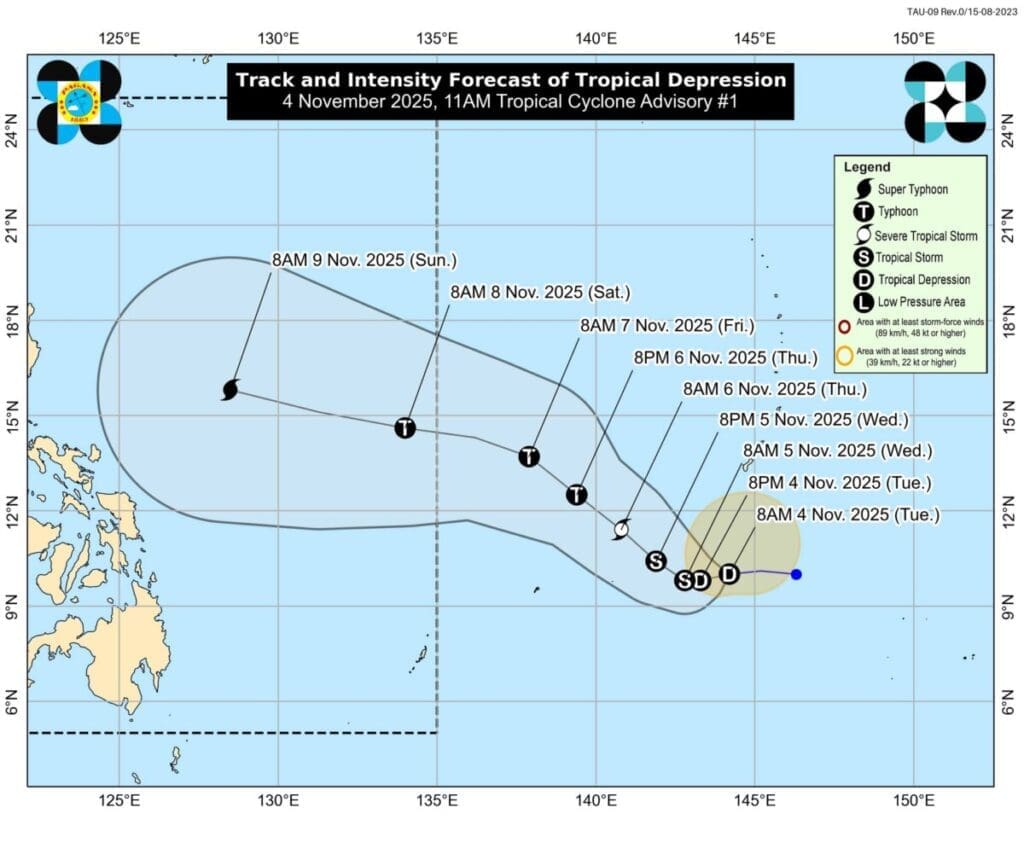
Current Location and Forecast

As of Tuesday morning (November 4), PAGASA reported the weather disturbance at 1,985 km east of Northeastern Mindanao, moving west at 20 kilometers per hour (kph). Containing a maximum sustained winds of 55 kph, with gustiness up to 70 kph. Once inside PAR (Philippine Area of Responsibility) it would be locally named Uwan, which is expected to strengthen rapidly.
The recent forecast models show maximum sustained winds that could exceed 185 kph—a threshold for a super typhoon, this coming weekend. PAGASA warns that while the exact track is uncertain, a landfall in the Philippines is increasingly likely. Updates will follow as the cyclone moves closer, so don’t ignore official bulletins, especially as landfall scenarios change daily.
Potential Impacts to Cebu and Eastern Visayas
By Saturday, rough to very rough seas are expected for the northern and eastern seaboards, stretching from Luzon to Visayas. This should be a time when Cebu residents should monitor conditions closely, as coastal flooding and dangerous waves may occur even before the system makes landfall.

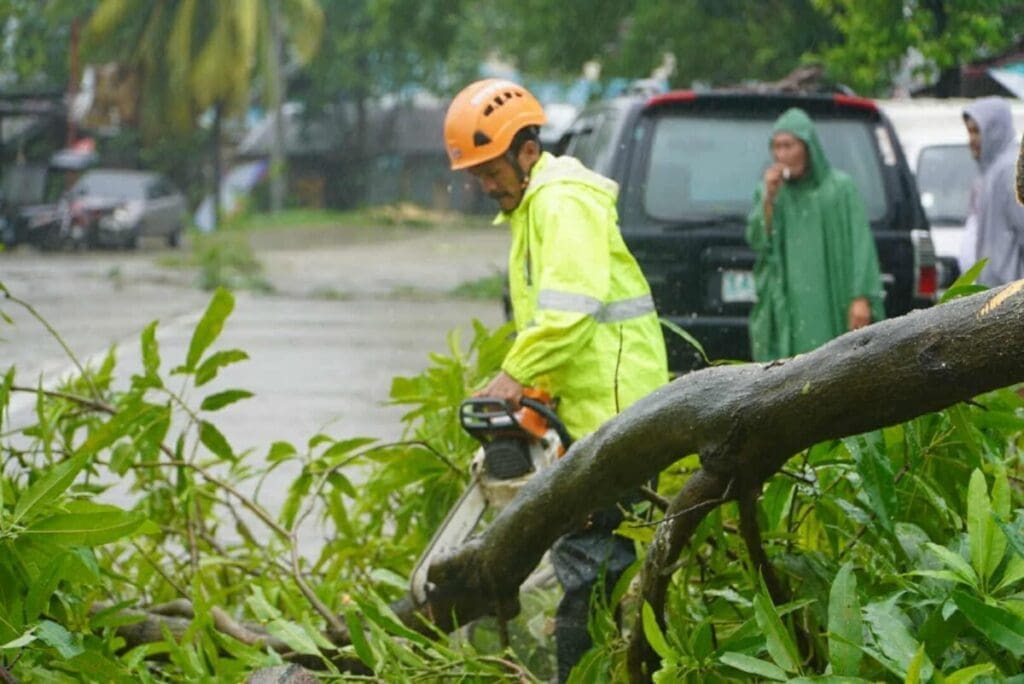
Typhoon Tino, as of current, is affecting central Philippines, bringing storm signals and “life-threatening conditions” over Camotes Islands and several parts of Cebu, with severe winds and rainfall, leading to flash floods and landslides in low-lying and mountainous areas. The forecast for super typhoon Uwan could mean powerful winds and rain of similar or greater intensity, especially for those living near the coastlines and rivers.
PAGASA’s Official Advisory

PAGASA emphasizes that any tropical depression outside the PAR is unpredictable, with rapid intensification possible as it moves over warm Philippine waters. The agency urges communities, particularly in Cebu, Leyte, Samar, and coastal provinces, to prepare emergency kits, secure homes, and be ready to evacuate if needed.
Local authorities may release preemptive evacuation orders and school suspensions as the cyclone gets closer. Barangays with histories of flooding or landslides should stay vigilant and follow instructions from disaster officials.
What Cebu Can Do Right Now

Cebuanos should actively monitor official updates every few hours and make sure mobile phones and power banks are charged for possible outages. Preparing a go-bag with flashlights, a first aid kit, canned food, and bottled water that can last for at least three days is crucial, as typhoon conditions can lead to supply disruptions and flooding.
Those living in flood-prone or coastal areas should know the nearest evacuation centers and check their barangay’s announcements about possible preemptive relocation. By adopting these steps, Cebu residents can safeguard their families and respond quickly when the threat of severe weather becomes real.